LiDAR Data Processing
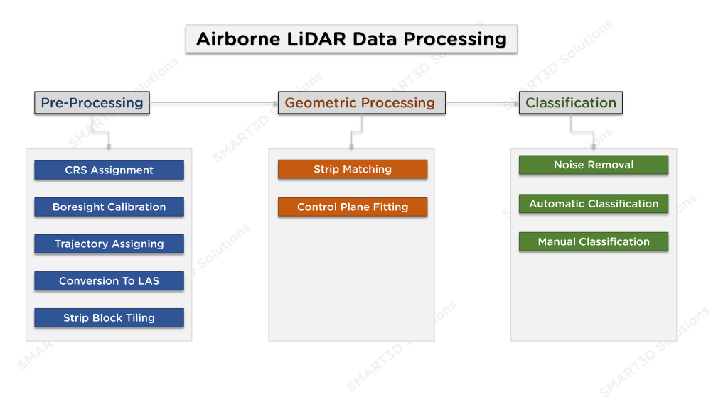
We have the ability to process all types of LiDAR data, whether aerial or terrestrial. The LiDAR data processing includes the steps of pre-processing, geometric correction, classification and creation of the final product. The workflow we use when processing airborne LiDAR data is given in Figure-1.
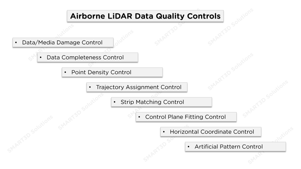
When processing LiDAR data, it is of great importance to perform quality control at every step to ensure that the resulting product has the desired quality. The quality control steps we use for this purpose are given in Figure-2.